
3d ser., 72, no. 2
April 2015
Interactive Digital Projects
Cohabitation, Suriname-Style: English Inhabitants in Dutch Suriname after 1667
Alison Games
Click on the images below for the interactive versions
Figure V
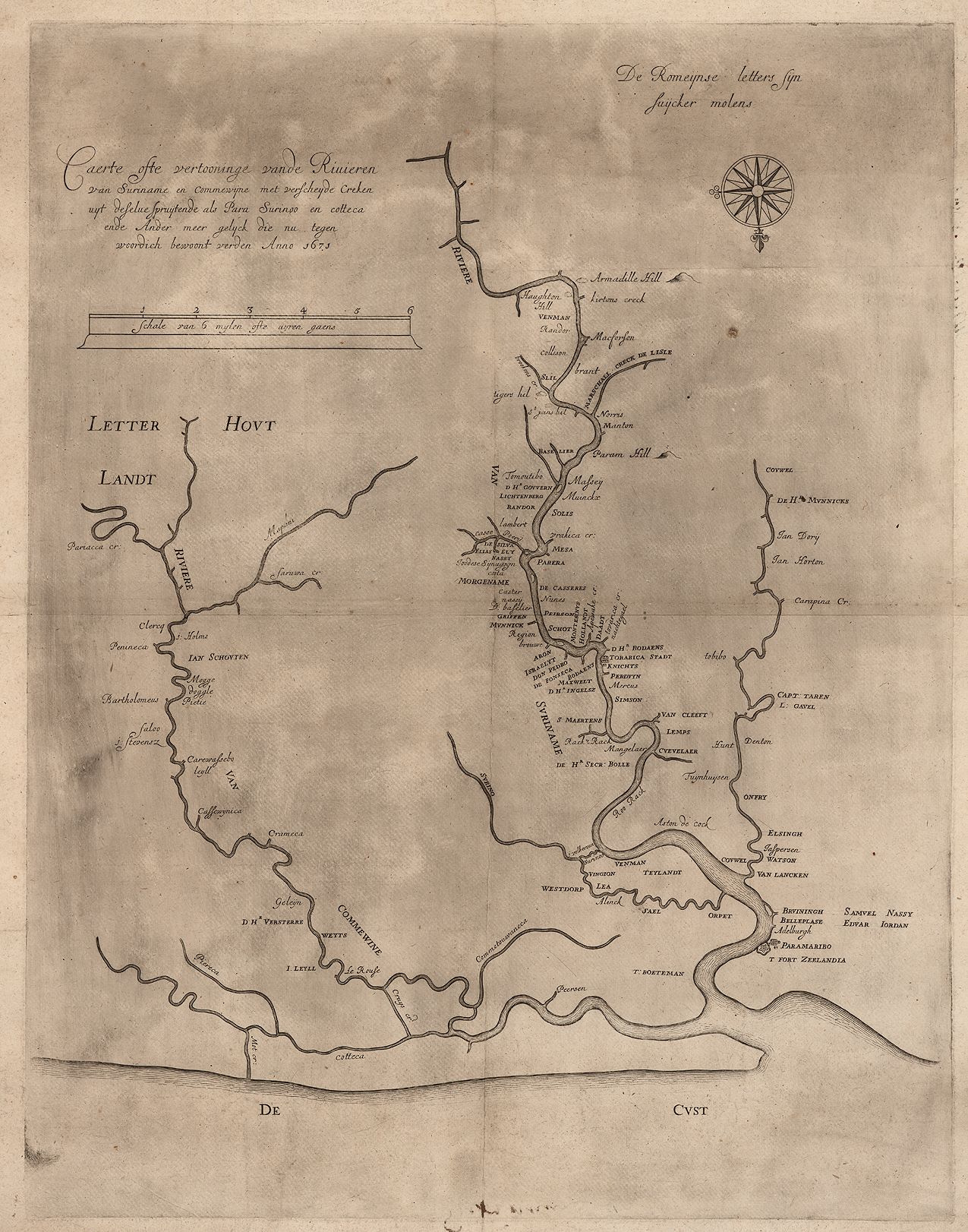
Caerte ofte vertooninge vande Rivieren van Suriname en commewijne met verscheyde Creken uyt deselue spruijtende als Para Surinoo en cotteca ende Ander meer gelijck die nu tegen woordich bewoont verden Anno 1671. This map of Suriname was made by the surveyor William Mogge, whose name appears along the Commewijne River on the left side of the map.
Image: Courtesy of the John Carter Brown Library at Brown University.
Figure VI
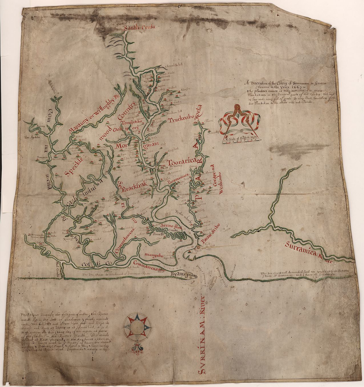
A Discription of the Coleny of Surranam in Guiana Drawne in the yeare 1667. This color map dates from the period of English occupation and shows the plantations’ locations along the main rivers and creeks.
Image: Courtesy of the John Carter Brown Library at Brown University.