
3d ser., 68, no. 1
January 2011
Interactive Digital Projects
Geographies of Power: Mapping Indian Borders in the “Borderlands” of the Early Southwest
By Juliana Barr
Spanish map from 1728
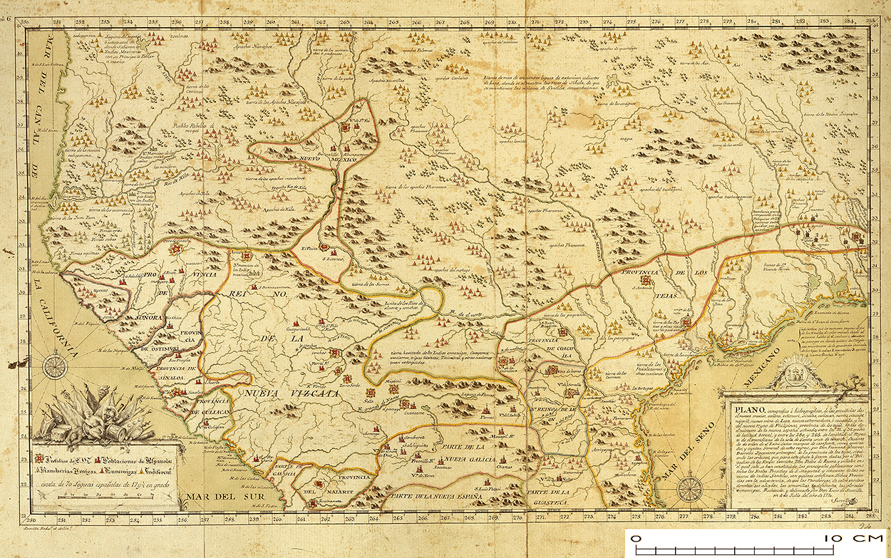
A 1770 copy of Francisco Álvarez Barreiro’s 1728 map of northern New Spain illustrating Spanish mapping of Indian domains in southern Texas and along the Gulf Coast, especially through the repetition of labels: “tierra de los Pampopas,” “tierra de los Carrizos,” “tierra de los Cujanes,” etc. © The British Library Board, MS 17,650.b.
Spanish map from 1744
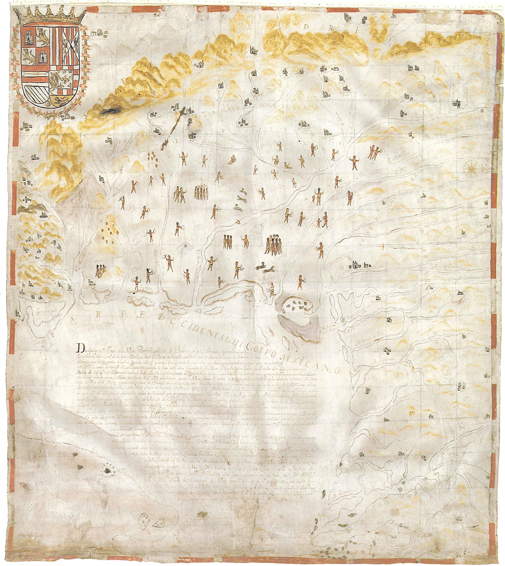
By covering the landscape with human figures in his map, Miguel Custodio Durán emphasized Indians’ dominion of the Texas, Nuevo Santander, and Nuevo León regions. Durán, Descripción y mapa de la nueva provincia poblada de bárbaros . . . situada en la costa del Seno Mexicano, desde el puerto de Tampico . . . hasta la provincia de Texas, 1744, 77.5 x 68.0 centimeters, in Octavio Herrera, El noreste cartográfico: Configuración histórica de una región (Monterrey, Mexico, 2008), 77. The original map is housed in Mapoteca Orozco y Berra, Varilla de Visitas, no. 127.
Interactive Map
These three interactive maps illustrate that no part of North America went unclaimed by Indians. The continent did not merely constitute their homelands but more concretely was divided into bordered domains of Indian bands, nations, chiefdoms, and confederacies. Beginning in the sixteenth century, European imperial powers might superimpose their own lines in attempts to legitimize vying territorial claims, but they did not negate the reality of Indian sovereignty and the power Indian nations exerted within unambiguous borders. The two Spanish maps from 1728 and 1744 make clear that Spaniards recognized Indian borders and that, in charting their own colonial goals in North America, they would have to negotiate the rules and controls of political and economic Indian jurisdictions.
Native American borders adapted from C. Matthew Snipp, American Indians: The First of This Land (New York, 1989), map 2.2, “American Indian Tribes, Circa 1600” (following p. 36). Drawn by Rebecca Wrenn.