
3d ser., 67, no. 4
October 2010
Interactive Digital Projects
The Merchant, the Map, and Empire: Augustine Herrman’s Chesapeake and Interimperial Trade, 1644–73
Christian J. Koot

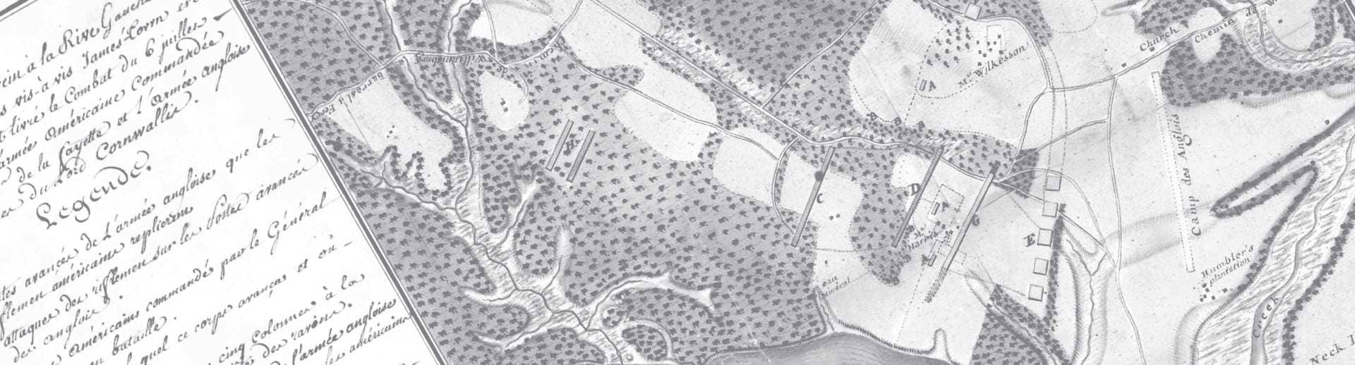
Augustine Herrman, Virginia and Maryland As it is Planted and Inhabited this present Year 1670 Surveyed and Exactly Drawne by the Only Labour and Endeavour of Augustin Herrman Bohemiensis; W. Faithorne, sculpt. London, 1673. Courtesy, Library of Congress, Geography and Map Division.
Blue indicating depth soundings denoted by numerals.
Green indicating plantation icons.
Yellow indicating Maryland-Virginia border on the Eastern Shore denoted by a double line of trees.